
GOSHEN COUNTY – June 20 was the official start to the summer and Mother Nature held her own private celebration across the skies of Goshen County Thursday afternoon with a handful of supercell …
This item is available in full to subscribers.
To continue reading, you will need to either log in to your subscriber account, below, or purchase a new subscription.
Please log in to continue |
GOSHEN COUNTY – June 20 was the official start to the summer and Mother Nature held her own private celebration across the skies of Goshen County Thursday afternoon with a handful of supercell thunderstorms, large hail, and tornados.
“A supercell thunderstorm developed near Chugwater, Wyoming on the afternoon of June 20, 2024,” according to the National Weather Service. “This thunderstorm produced two tornadoes as it traveled eastward.”
According to the weather service, a land spout was also reported in Goshen County.
“A brief tornado was observed in rural Goshen County by numerous storm spotters and emergency management personnel. Due to the rural nature of this tornado, only limited damage to fencing was found, as well as scattered plant debris,” the National Weather Service released in a recent report. “Review of video and photo sequences along with radar time-matching indicated that this tornado likely began as a land pout, but quickly gained mesocyclonic characteristics as it interacted with the updraft base, condensed a funnel, and slowed/occluded into the storm. Regardless, without any damage of note, this tornado will be recorded as EF-U.”
The report indicated the land spout had an unknown peak wind and it was under .5 miles in length and under 20 yards wide. It was reported 7.5 miles northwest of Hawk Springs at 2:40 p.m. and it ended six miles northwest of Hawk Springs five minutes later.
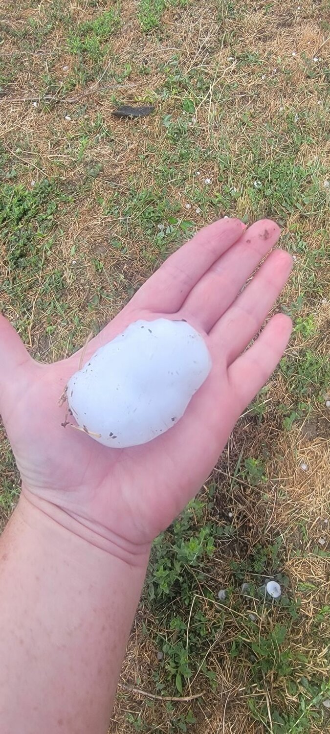
The storm continued across the rural areas of Wyoming, dropping large hailstones, and sending debris flying in the nearly 100 mph wind.
According to Goshen County Emergency Management, Thom Bozeman, the storm system produced damaging hail and straight-line winds.
“We had reports of hail damage across the entire county, from Platte County to the Nebraska line, with damage consisting of vegetation, homes, and vehicles. There was also wind damage to fencing and vegetation from the landspout as it transformed into a tornado northwest of Hawk Springs,” Bozeman explained. “The landspout started about 7.5 miles northwest of Hawk Springs and was heading northeast. It quickly began converting into a tornado and stayed on the ground for approximately 0.5 miles before lifting back into the clouds,” Bozeman continued.
The storm spun a second tornado near Morrill, Nebraska Thursday afternoon as well which was rated an EF-1 on the Fujita Scale with an estimated peak wind speed of 100 mph.
The second tornado was reported at 3:29 p.m., 2.5 miles southeast of Morrill and it reported dissipated at 3:34 p.m., four miles southeast of the town.
“The National Weather Service damage survey found evidence of EF-1 tornado damage at multiple properties along County Road D as well as along highway 26. One resident had partial roof structure failure as well as roofing material completely removed,” the National Weather Service stated in their report. Another garage facility experienced total structural collapse and foundation shift. Numerous large tree limbs one to two feet in diameter were snapped and scattered. Several smaller metal outbuildings were also destroyed and scattered,” the report continued.
The National Weather Service indicated their reports were preliminary and subject to change, pending final review of the event and publication in storm data.
“Of important note, this tornado occurred along the northern fringe of a much larger area of powerful straight-line outflow winds observed in excess of 90 to 100 mph,” the weather service explained. “Damage indicators from the straight-line winds throughout Scotts Bluff County were all pointed eastward. This was in dramatic contrast to the tornado path which featured a chaotic scattering of damage and debris, some of which was lofted north and even back west of the circulation path.”
Residents in the path of the storm system were lucky, according to Bozeman.
“Luckily, we had no severe damage or injuries that the county is aware of. After review, the NWS determined that the landspout/tornado rating was EF-U,” Bozeman said. “The county used weather spotter information, the outdoor warning sirens, mass Notification, and IPAWS (Integrated Public Alert and Warning System) to alert our citizens as this storm developed. I couldn’t be prouder of our team in their performance during these storms,” Bozeman concluded.


