
GOSHEN COUNTY – Parts of Goshen County experienced a much-needed rain shower this weekend as the area saw temperatures in the 80s, however, according to the National Weather Service (NWS), dry, …
This item is available in full to subscribers.
To continue reading, you will need to either log in to your subscriber account, below, or purchase a new subscription.
Please log in to continue |
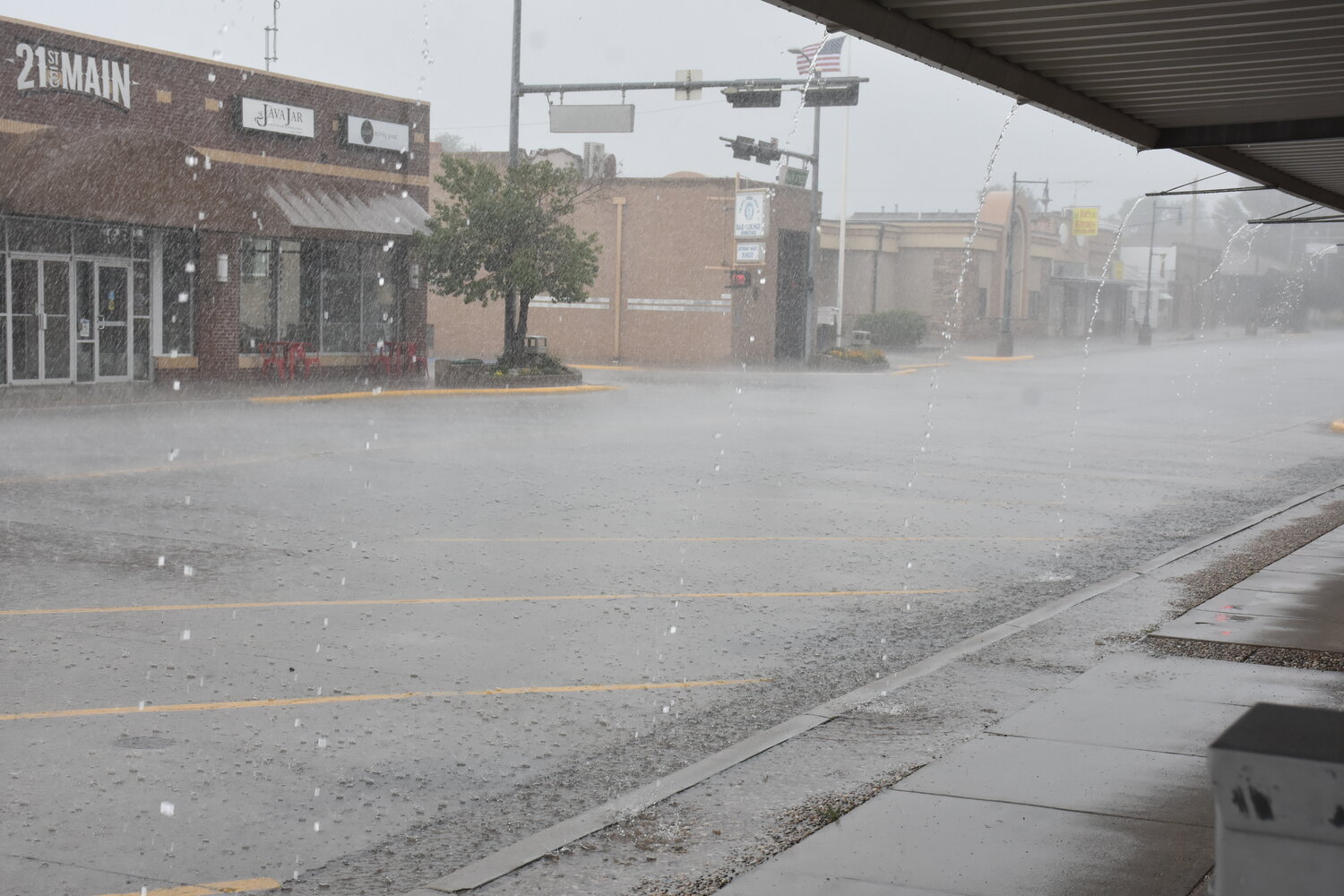
GOSHEN COUNTY – Parts of Goshen County experienced a much-needed rain shower this weekend as the area saw temperatures in the 80s, however, according to the National Weather Service (NWS), dry, hot days are ahead and smoke from area wildfires will also continue to settle into the region.
According to the weather service, parts of Goshen County received a small amount of precipitation Friday afternoon into Monday morning.
Lead forecaster, Gerry Claycomb, with the Cheyenne NWS office reported parts of Goshen County received upwards of over an inch of rain on Saturday. Claycomb expressed even though the area did receive some moisture, we are still behind in total precipitation for the month of July and the entire year.
As for the beginning of the workweek, mild temperatures were forecasted in much of the region as the area experienced the influence of the building of an upper-level ridge across the Intermountain West, according to the weather service.
“Geostationary Operational Environmental Satellite (GOES)-16 visible satellite imagery depicts a very large swath of wildfire smoke propagating from further upstream again today. This has resulted in lower visibility across portions of the Nebraska Panhandle earlier this morning (Monday, July 22), and has limited the daytime high potential this afternoon because of the pesky haze aloft. Daytime highs are the coolest across the higher terrain of southeast Wyoming, with warmer temperatures east of the Laramie Range and the Nebraska Panhandle. The latest HRRR (High-Resolution Rapid Refresh) smoke experimental model depicts the vertically integrated smoke along the column dissipating close to sunset this evening, but it will still be present aloft overnight due to the stagnant weather pattern,” the weather service explained.
On Tuesday, July 23, the upper-level ridge centered over the desert southeast, moved east and the area experienced a warm air advection, where warm area moves into the region, according to the weather service.
Claycomb explained the cool temperatures are from the north which is why much of the area has seen smoke haze on the horizon.
On Wednesday, NWS anticipates climbing temperatures with mostly dry conditions according to predicted forecasts with a Wednesday high of 99 degrees.
“A few weak thundershowers may crop up by the late afternoon hours due to conditional instability. Severe weather isn’t expected, however. There may be a slight risk of dry thunder in the western forecast zones for late Wednesday. The relative humidity will begin to also be at near-critical thresholds for the region,” NWS explained. “Minimum humidity values of 12-20% are likely, and we will need to monitor the wind speeds in the event that a fire headline is needed east of the Laramie Range. Expect daytime highs in the 90s to low 100s east of the Laramie Range, with slightly cooler temperatures west of the Laramie Range.”
Evening temperatures will be pleasant throughout the region tonight.
“Mild temperatures will remain through Wednesday night, with lows in the middle 50s to upper 60s. Isolated areas in the mountain zones above the nocturnal inversion will dip into the 40s. The general trend is for temperatures to increase the next couple of days, with a slow trend of dissipating chances of rain showers,” the NWS said.
The warming trend will continue on Thursday with a high near 103 degrees, according to Claycomb. Friday is anticipated to be a little cooler with a projected high of 99 degrees.
Claycomb reports temperatures will be in the high 90s for much of Goshen County throughout the weekend however the possibility of precipitation increases.


