

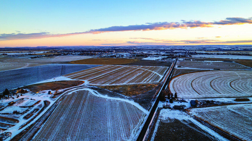
GOSHEN COUNTY – A blizzard warning has been issued for much of southeast Wyoming, including Goshen County and Torrington where snowfall is expected to between 8-12 inches and is expected to last through much of the week.
According to National Weather Service (NWS) of Cheyenne Meteorologist Michael Natoli, southern Goshen County is expected to see higher amounts of snowfall compared to northern parts of the county.
“The average snowfall forecast for Goshen County currently is between 8-12 inches,” Natoli explained. “Southern Goshen is expected to see a 90% probabilistic snowfall of 14 inches or less and northern Goshen is expected to see a 90% probabilistic snowfall of 6 inches or more.”
Natoli explained to the Telegram probabilistic snowfall forecasting is one in which forecasters convey uncertainties by expressing forecasts as probabilities of various outcomes – in particular with larger areas or with storms with rapidly changing weather variables and conditions.
“In terms of this current storm using probabilistic snowfall forecasting, we can say with near certainty, or a 90% probability Torrington, for example, will see roughly 6 inches of snow or more with this upcoming storm,” Natoli explained.
Natoli further explained, using this forecasting model for Wyoming, Goshen County and Torrington, NWS has been regularly successful in inclement weather predictions.
Prior to last week’s storm, which dumped 1.2 inches of snow in Torrington within the span of roughly eight hours on Thursday, NWS accurately predicted a snowfall of 1-2 inches in Torrington and county wide .5-1.5 inches of snow.
“Bearing in mind, Torrington is not yet an official record recording meteorological site because we’ve not had samples from Torrington or Goshen County for 30 years yet, I can say the weather conditions and temperatures have been lower than what is typically expected seasonally in Torrington and Goshen County,” Natoli told the Telegram.
NWS has been relying on locals to provide weather samplings from Torrington and Goshen County since 1998; in six years Torrington will become a record recording meteorological site for NWS. Currently, NWS relies on a number of other sources for historical weather data collections.
“Temperatures for Torrington thus far for this season have been pretty close to normal and a little below what we ordinarily expect,” Natoli said. “The morning averages have been pretty cold and lower than previous years while the afternoon temperatures have been slightly warmer.”
Adding, “With the current storm projection outlooks we have right now, we are expecting to see higher than normal snowfall in much of Goshen County, particularly in Torrington, Yoder, LaGrange and most of southern Goshen County.”
As of Monday afternoon, Natoli said NWS expects at least 0.5 inches in northern parts of the county, like Fort Laramie and upwards of 12-14 inches in the southern parts – but said due to the storm being slow-moving and unpredictable, those totals could change throughout the evening and into Wednesday as well as a possibility of going into Thursday.
NWS issued a ‘Blizzard Warning’, its highest level of watches and warnings, for the eastern half of Wyoming from Laramie up to Wright and eastward toward Torrington into the Nebraska Panhandle. The warning went into effect on Monday, Dec. 12 at 5 p.m. and will remain in effect until 11 p.m. Wednesday night. The blizzard warning could extend through Friday, but that decision has not yet been made.
A blizzard warning is the top of seven wintery weather conditions NWS uses. Other wintery weather conditions from highest to lowest include:
According to NWS, a blizzard warning is issued when the following conditions are expected for at least three hours: expected snowfall accumulation range is at least between 4-10 inches; when whiteout conditions are expected, and visibility is less than 1/4 mile due to falling and/or blowing snow; when winds are expected to exceed 35 miles per hour (mph) and when wind chill is expected to be near 0 or in the negatives.
The difference between a winter storm warning and a blizzard warning is that during a winter storm warning heavy snow is expected in a rapid and short amount of time but conditions allow for light travel. For instance, a winter storm warning would be issued when heavy snow of at least 6 inches or more is expected in a 12-hour period or 8 inches or more in a 24-hour period.
“As we continue to monitor this storm and track it, storm warnings and watches can be updated for different areas across the state, however, for Torrington and Goshen County we are fairly confident in the weather forecast and snow predictions,” Natoli further explained. “I just want to remind people this storm coming in can be deceiving because of how slow moving it is, the rotation of the storm and the direction in which the storm is coming from.”
This blizzard, as explained by NWS during a live event for media partners and community members on Monday night, has come some from the Gulf coast and some from the southwest pacific coast and as of Tuesday morning was swirling in a circular pattern as it moved through the state and slightly northwest.
“Conditions are expected to deteriorate Tuesday morning and afternoon but can possibly intensify into Wednesday because it’s a slow-moving storm,” Natoli stated.
According to Natoli, the next few days will be extremely cold due to temperatures and windchill.
“On Tuesday the high is expected to be 21 degrees Farhenheit and a windchill of below 0 which will hold steady and decline at times to a windchill of -5 going into Wednesday,” Natoli said. “The high on Wednesday will be slightly higher at 24 degrees Fahrenheit but still with a negative windchill of about 5.”
Natoli said Thursday wasn’t looking much better with a high of 25 degrees Fahrenheit and a windchill of 0 to +5.
Per the updated NWS Cheyenne website on Tuesday morning at 7 a.m., the forecast was as such:
Tuesday: Heavy snow at times throughout the day with widespread blowing snow of which NWS would fall the heaviest before 3 p.m. for a total daytime snow accumulation of 3-7 inches. Winds between 25-30 mph and gusts of up to 45 mph with a high of “near 23” degrees Fahrenheit.
In the evening, NWS temperatures will drop to around 14 degrees Fahrenheit with winds continuing to be between 25-30 mph and gusts of up to 45 mph. However, there will be intermittent periods of blowing snow and another 1-2 inches of snow possible Tuesday night.
Wednesday: NWS believes most of the snow will fall before noon in Torrington and much of Goshen County as widespread blowing snow continues through the lunch hour. The high is expected to be near 24 degrees Fahrenheit with a wind chill value of between -5 and 5. Winds will remain between 25-40 mph with gusts of up to 45 mph. About an inch or less of snow is expected to fall Wednesday during the day.
Light snow accumulation of 1 inch or less is expected to continue Wednesday night with patchy periods of blowing snow and a low of 13 degrees Fahrenheit. Wind chill conditions are not expected to improve.
Thursday, NWS says to expect moderate to light patchy blowing snow throughout the day and into the evening with a partly sunny day at times and a high of near 27 degrees Fahrenheit. Wind chill is expected to resend slightly but strong winds are expected to remain between 25-30 mph with gusts of up to 45 mph.
Friday, Saturday and Sunday are reported to be similar to Thursday evening and Friday day with nighttime lows dipping into the negatives.
Due to the winter blizzard, Goshen County School District (GCSD) issued a virtual snow day and LaGrange canceled its field trip to be rescheduled sometime in January.
According to GCSD Superintendent Ryan Kramer, “Our contingency is children were sent home with materials and packets on Monday in anticipation of the possibility of calling a virtual snow day.”
Adding, “We will continue to track this storm and make adjustments as needed and be communicative to our parents and families we serve.”
Kramer told the Telegram of the school closures moments before the school board meeting as he was waiting for the district to make a determination following an update from NWS in the late afternoon, early evening. He also announced the virtual snow day during his Superintendent’s report to board members and those in attendance in-person and online during the board meeting. Future Telegram stories will detail the school board meetings from Monday night.
All districts in southeast Wyoming issued traditional snow days and/or virtual snow days.
As of 5 p.m. Monday night, NWS issued an update to the current storm's tracking which stated Torrington and Goshen County can expect the worst part of the storm on Tuesday between 6 a.m. and midnight. However, the weather agency said Torrington and Goshen County can expect a slow tapering off of the storm from Wednesday into Thursday.
“I think the slowness of the storm might shock some people, but they will still need to be hyper vigilant when traveling or resuming normal activities from Tuesday going into Friday morning,” Natoli further explained. “We are working with our partners at WYDOT (Wyoming Department of Transportation) in looking at road conditions across the state, but in particular in southeast Wyoming – so Cheyenne up to Torrington and into Lusk.”
“Very bitter, strong and blustery winds, conditions, temperatures are expected to remain throughout the week into the weekend,” Natoli said.
As of 7:30 a.m. Tuesday morning, a representative from WYDOT said several road closures from Central Wyoming to Eastern Wyoming have been issued due to vehicle accidents and road conditions. Near Goshen County that included:
Isolated parts along US Highway 85 (HWY-85) north and south were closed from Lagrange to Yoder due to road conditions. A no unnecessary travel was issued for LaGrange, Hawk Springs and Yoder residents along the HWY-85, more noteworthy heavier restrictions placed between Wyoming Highway 161 (WY-161) from Hawk Springs and Silvertip into Torrington.
Wyoming Highway 313 (WY-313) was closed in both directions Tuesday morning due to road conditions and a vehicle accident of which WYDOT doesn’t expect it to reopen until possibly Wednesday once snowplows can make its way to that highway.
Parts of Interstate 25 (I-25) from Cheyenne up to Wheatland was closed due to black ice, vehicle crashes, low visibility and high winds Tuesday morning, much of that highway wasn’t expected to open until late Tuesday afternoon.
WYDOT issued a no unnecessary travel on West HWY-85/East US Highway 26 (Hwy-26) through Torrington and Lingle for Tuesday and didn’t expect conditions to improve until late afternoon Wednesday. WYDOT expects travel restrictions on HWY-85 to affect Fort Laramie, Guernsey and Lusk.
Wyoming Highway 151 (WY-151) through LaGrange was also closed Tuesday and similarly to WY-313 isn’t expected to open until late Tuesday night or early Wednesday morning.
Wyoming Highway 154 (WY-154) into Veteran was also closed Tuesday morning and isn’t expected to reopen until Wednesday.
Wyoming Highways 92 and 161 (WY-92 and WY-161) going through Huntley were both closed Tuesday morning and like other smaller highways in, near and around Goshen County, are also not expected to reopen until late Tuesday evening or Wednesday morning.
Wyoming Highway 160 (WY-160) from Fort Laramie to Wheatland was also closed due to road conditions and is also not expected to reopen until late Tuesday evening or Wednesday morning.
Just before 8 a.m. Tuesday morning, WYDOT issued a no oversized loads, Class 4 restriction on traveling the I-25 from the Colorado state line through Cheyenne to Chugwater into Wheatland, as well as on HWY-85, HWY-26 and all other state highways in Goshen, Laramie, Platte and Niobrara counties.
Similarly, the Nebraska Department of Transportation (NDOT) issued the same restrictions and closed highways between Wyoming and Nebraska Tuesday morning just before 8 a.m.
Both WYDOT and NWS Cheyenne ask Wyomingites to check social media pages, call 5-1-1 and/or webpages at www.wyoroad.info or www.weather.gov/cys for current weather and road conditions as well as any travel restrictions. The Telegram will continue to monitor and update the weather information online at www.TorringtonTelegram.com.
“This storm is slow moving but conditions can rapidly change in a short period of time and distance as people travel to and from school or work the next several days, so we are asking residents to keep up to date with current weather conditions as well as road closures via our website and social media or with WYDOT’s social media and website,” Natoli explained. “Residents can always call 5-1-1 for current road conditions, closures and restrictions and of course, if they become stuck, they can call 9-1-1 for help.”
Torrington Police Department (TPD) Chief Matt Johnson told the Telegram, “It’s a great day to stay home with your family and enjoy the blizzard from home.”
Adding, “This blizzard is an unintentional blessing in which residents can enjoy a day home with their families because road conditions are unfavorable and extremely slick as well as accident prone.”
“The highways around Goshen County – more specifically around Torrington are far worse than the road conditions in Torrington city limits due to the blowing wind and snow as well as very dicey and icy conditions,” Johnson further explained. “TPD is working very diligently to clear any accidents and help residents as snow-related issues arise but want to reiterate what the state departments (NWS and WYDOT) have already issued – that residents should not be traveling unless they absolutely, positively have to because the highway conditions are just incredibly icy and really very unsafe.”
Johnson also explained how the department has been out in the storm offering help to travelers already and noted several county roads and highways are not suitable for traveling on Tuesday. He also stated the department will work with other county and city departments to update about road and travel conditions as well as with state departments.
“Today is really the best day to just stay home and enjoy your family so that everyone stays safe, even at low speeds drivers can quickly lose control of their vehicles and end up endangering themselves or other drivers,” Johnson said. “It’s really just not safe to even run up to the gas station or bank right now, I would just really encourage residents to enjoy their families at home today where it’s warm.”
“The highways near Torrington are just brutal right now, very dicey and very icy and at times visibility is low due to the wind and blowing snow. I think the state department and its partners with the weather service said we can expect this to last through today and possibly most of Wednesday” Johnson added.
Johnson said residents who find themselves in dangerous situations or become stuck can call TPD and/or 9-1-1 for assistance. They also encourage residents to notify insurance companies in the event of a vehicle accident. Johnson reiterated WYDOTS restrictions of oversized load traveling, adding the conditions around Torrington are not safe for any sort of travel, specifically larger profile vehicles or oversized loads due to icy conditions and poor visibility.
Goshen County Sheriff's Office Sheriff (GCSO) Kory Fleanor was available to make a safety statement prior to publication deadline.


