

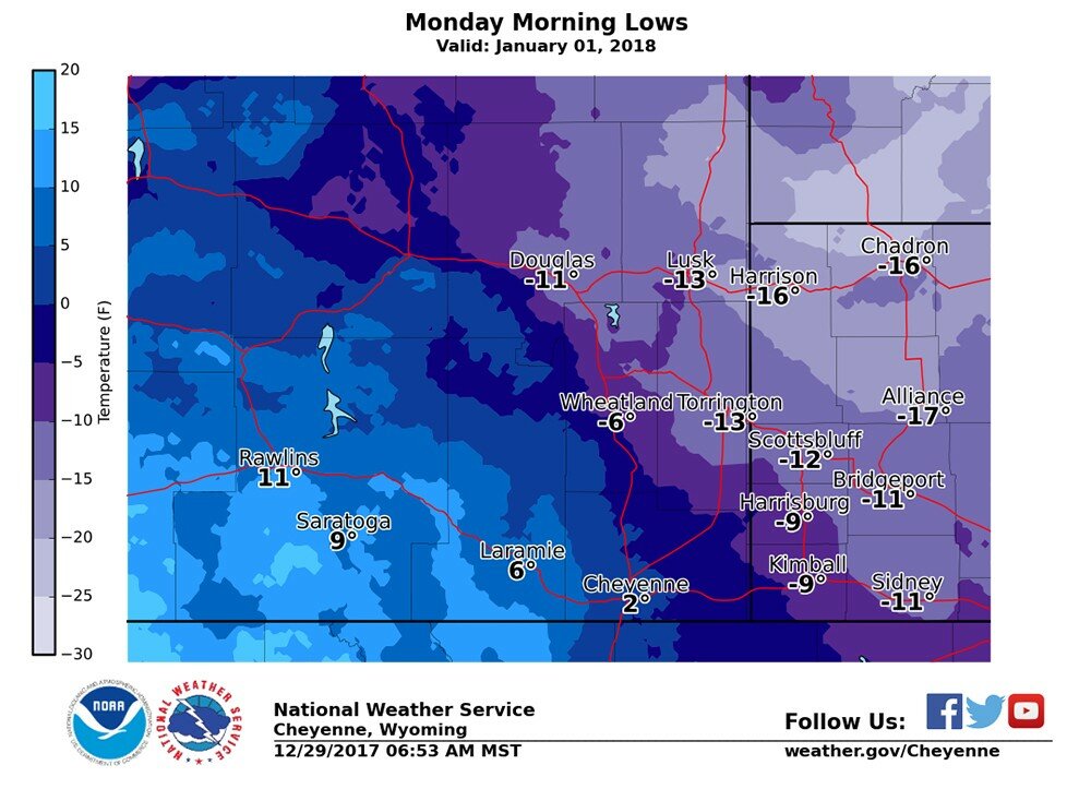
CHEYENNE – The New Year is expected to start off frigid, with temperatures across much of eastern Wyoming and western Nebraska barely breaking double-digits – if at all – as an Arctic air mass descends on the region this weekend.
The cold air is expected to begin moving into the area late today (Friday) and into tonight, according to a release from Chad Hawn at the National Weather Service forecast center in Cheyenne. A second surge of Arctic air, currently located off the coast of the Pacific Ocean, will follow on Saturday, bringing with it dangerously cold temperatures with projected wind chills ranging to minus-30 degrees Sunday and into Monday, Hahn said.
That front “should bring a little snow with it,” said meteorologist Brian Chapman in Cheyenne. “But we’re not really talking any significant accumulations. I’d think and inch or less, from what it’s looking like now.
“The big story is the wind chills,” he said. “From Saturday night and into Sunday, we’re look at 10 to 20 degrees below zero.”
When the wind chill reaches those levels, frostbite becomes a very real concern, Chapman said. Exposed skin can freeze in as little as 30 minutes.
“So, keep gloves on, keep your hats on, dress in layers,” he said. “All that good stuff.”
The good news is this spate of cold weather should move through the area quickly. Chapman said actual temperatures Sunday night going into Monday will be around minus-14 degrees, with warming expected as early as Tuesday with temperatures in the 30s and continue through the week.


