

CHEYENNE – A strong Pacific storm has come ashore along the Washington State coast, bringing with it the threat of rain and even a chance of snow for southeast Wyoming and portions of northern Colorado.
According to a press release from the National Weather Service forecast center in Cheyenne, rain and thunderstorms are anticipated through Wednesday afternoon (today). An influx of cold air Wednesday evening will increase the chances of snowfall at higher elevations heading in to the end of the week.
The forecast holds “moderate to high confidence” the storm will impact travel at elevations greater than 7,500 feet, including the Snowy Range, the Interstate 80 summit west of Cheyenne, northern Laramie Range and the Elk Mountain and Arlington areas along I-80 between Rawlins and Laramie. The storm holds the potential to deposit as much as 12 or more inches of heavy, wet snow at these higher elevations.
Lower than 7,500 feet, there’s a minimal chance of travel impacts, the release said. But that depends on the changeover from rain to snow. Little if any snow accumulation is anticipated at elevations less than 5,000 feet.
Some areas may experience power outages caused by heavy, wet snow impacting spring foliage and power lines. The areas of greatest concern include the Laramie, Albany and eastern Carbon counties in Wyoming.
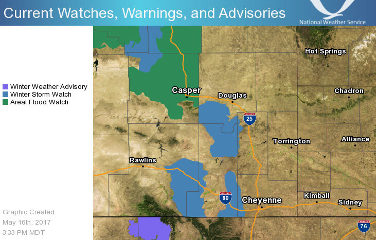
Winter Weather Advisories are in effect for portions of northern Colorado and Winter Weather Watches are in effect south of Douglas and along the I-80 corridor between Cheyenne and Rawlins. Flood Watches are also in effect for areas around and north and west of Casper.
Predominantly rain is anticipated for portions of the Nebraska Panhandle. The potential for moderate to heavy rain means streams and creeks will likely rise going into the weekend.


