

Winter storm could impact travel, safety in southeast Wyoming
This item is available in full to subscribers.
To continue reading, you will need to either log in to your subscriber account, or purchase a new subscription.
If you are a current print subscriber, you can set up a free website account and connect your subscription to it by clicking here.
If you are a digital subscriber with an active, online-only subscription then you already have an account here. Just reset your password if you've not yet logged in to your account on this new site.
Otherwise, click here to view your options for subscribing.
Please log in to continue |
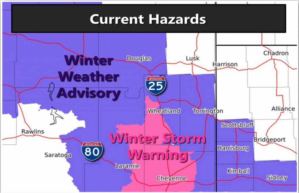
CHEYENNE – A Winter Weather Advisory has been issued through Sunday morning for portions of southeast Wyoming and southwest Nebraska, including all of Goshen County.
In addition, a Winter Storm Warning has been issued for parts of Albany, Laramie and Platte counties, including interstates 25 and 80. Rain turning to snow is predicted to make travel conditions dangerous on these and other roads in the warning area.
According to the National Weather Service in Cheyenne, as much as 8-inches of snow could fall in the warning area, with snowfall projected from 2-inches in the Torrington area to 6-inches around Wheatland. Rain is expected to develop from north to south this afternoon, turning to snow by early evening.
The heaviest snowfall is anticipated between 6 p.m. Saturday and 6 a.m. Sunday, with rates as much as 1- to 2-inches in the warning area. North winds between 15 and 25 miles per hour are expected, resulting in blowing and drifting snow, which could further impact travel.
Bitter cold wind chills are expected with possible record low temperatures of zero to 15-degrees anticipated Saturday night and Sunday morning. Wind chills could reach minus-15 degrees, meaning frostbite could occur with as little as 30-minutes exposure.
Significant travel impacts are expected Saturday night and into Sunday, particularly in the warning areas of Laramie, Albany and Platte counties. Greatest impacts will probably be from the Interstate 80 Summit area into Cheyenne.


