

CHEYENNE – Though it's usually a March axiom, November could come in like a lion, as strong winds move into areas of eastern Wyoming tonight and into tomorrow, according to an alert from the National Weather Service forecast office here.
Rob Cox, science and operations officer for the NWS in Cheyenne, said early Tuesday an upper-level system is anticipated to move into the High Plains region out of Montana tonight and into Wednesday. This disturbance will cause strong winds to develop late tonight, spreading onto the Wyoming plains beginning around 6 p.m. Tuesday and continuing through 6 p.m. Wednesday.
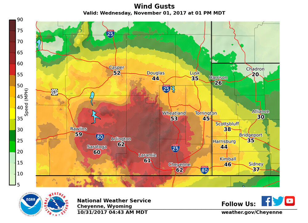
Wind gusts upwards of 80 miles per hour will be possible in wind-prone areas around Arlington and Bordeaux along Interstate 80 west of Laramie. Areas further east, including Torrington and Goshen County, could see gusts topping out from 60 to 70 mph throughout the event, Cox said.
Areas of western Nebraska could see gusting to 50 mph, primarily during the day on Wednesday as well, which could result in elevated fire weather conditions, he said.
Specific wind forecasts include 45 mph in the Torrington area, 35 mph in and around Lusk, 50 mph or greater in and south of the Wheatland area along Interstate 25 and 60-plus mph near and north of Cheyenne.
High winds can cause driving issues, particularly in open, wind-prone areas along I-80 and I-25. People driving lightweight, high profile vehicles are advised to avoid travel during these times, Cox said.
Contact the National Weather Service forecast office in Cheyenne at (307) 772-2227 with questions or concerns.


